Istanbul public transport guide — metro, tram, bus, and ferry explained
Istanbul: Hop-On Hop-Off Bus Ticket
How does public transport work in Istanbul?
Istanbul has an integrated public transport system — metro, tram T1, Marmaray rail tunnel, buses, ferries, and funiculars — all accessible with the Istanbulkart rechargeable card. For tourists, the T1 tram (Sultanahmet to Karaköy), the Eminönü-Kadıköy ferry, and the M11 airport metro cover most needs.
Istanbul’s transport network: the overview
Istanbul’s public transport network is extensive, multi-modal, and integrated under the Istanbulkart payment system. Understanding how the pieces fit together makes getting around straightforward; arriving without any knowledge can feel overwhelming.
This guide maps the full system for tourists — focusing on the lines and routes you will actually use.
| Payment | Istanbulkart (contactless card), one card for metro, tram, bus, ferry, Marmaray, funiculars |
| Typical fare | Around 17-25 TRY per tap, with a discounted “aktarma” transfer fare within roughly 90 minutes |
| Card cost | Around 100 TRY for the card itself, refillable at any station or kiosk |
| Airport link | M11 metro (IST) or HAVAIST/HAVABUS buses; see our airport transfer comparison |
| Operating hours | Roughly 6 AM-midnight on most lines, longer on the M11 |
| Best first move | Buy an Istanbulkart at the airport or first station, top it up generously |
The Istanbulkart: the system’s foundation
Every mode of public transport described in this guide accepts the Istanbulkart contactless card (with the exception of private ferry and bus companies). Buy one at any metro station or ferry terminal on arrival.
Cost: 100 TRY for the card + credit loaded. Standard trip cost approximately 17-25 TRY ($0.50-0.75 USD) per segment. The card is used across metro, tram, bus, ferry, Marmaray, and funicular.
See our Istanbulkart guide for the full details, and our broader getting around Istanbul overview if you want the short version before diving into line-by-line detail below.
Metro lines: the backbone network
Istanbul has an expanding metro network currently covering both the European and Asian sides. Key lines:
M11: Istanbul Airport to city
The most important metro line for arriving visitors. Runs from Istanbul Airport (IST) to Gayrettepe, where it connects to the M2.
- Journey time IST → Gayrettepe: approximately 35-40 minutes
- Frequency: every 8-12 minutes
- Accepts Istanbulkart
At Gayrettepe, transfer to the M2 for Taksim and Yenikapı connections.
M2: Yenikapı to Hacıosman (European side north-south)
The main European-side metro spine. Key stops:
- Yenikapı: Connection to Marmaray (for Asian side and Sirkeci/Eminönü area)
- Vezneciler: Near Istanbul University and the Süleymaniye area
- Taksim: Taksim Square, top of İstiklal Avenue, cable car to Kabataş
- Şişli/Mecidiyeköy: Business district
- Levent: Shopping malls and business area
- Gayrettepe: M11 airport metro connection
From Yenikapı on the M2, you can board the Marmaray toward Sirkeci (walking distance to Sultanahmet and Eminönü) or east toward the Asian side.
M4: Kadıköy to Sabiha Gökçen Airport (Asian side)
Serves the Asian side from Kadıköy through the suburbs to SAW airport.
- Key stop: Kadıköy — main Asian neighborhood and ferry terminal for European crossings
- Useful for SAW airport arrivals staying in Kadıköy or needing onward connections
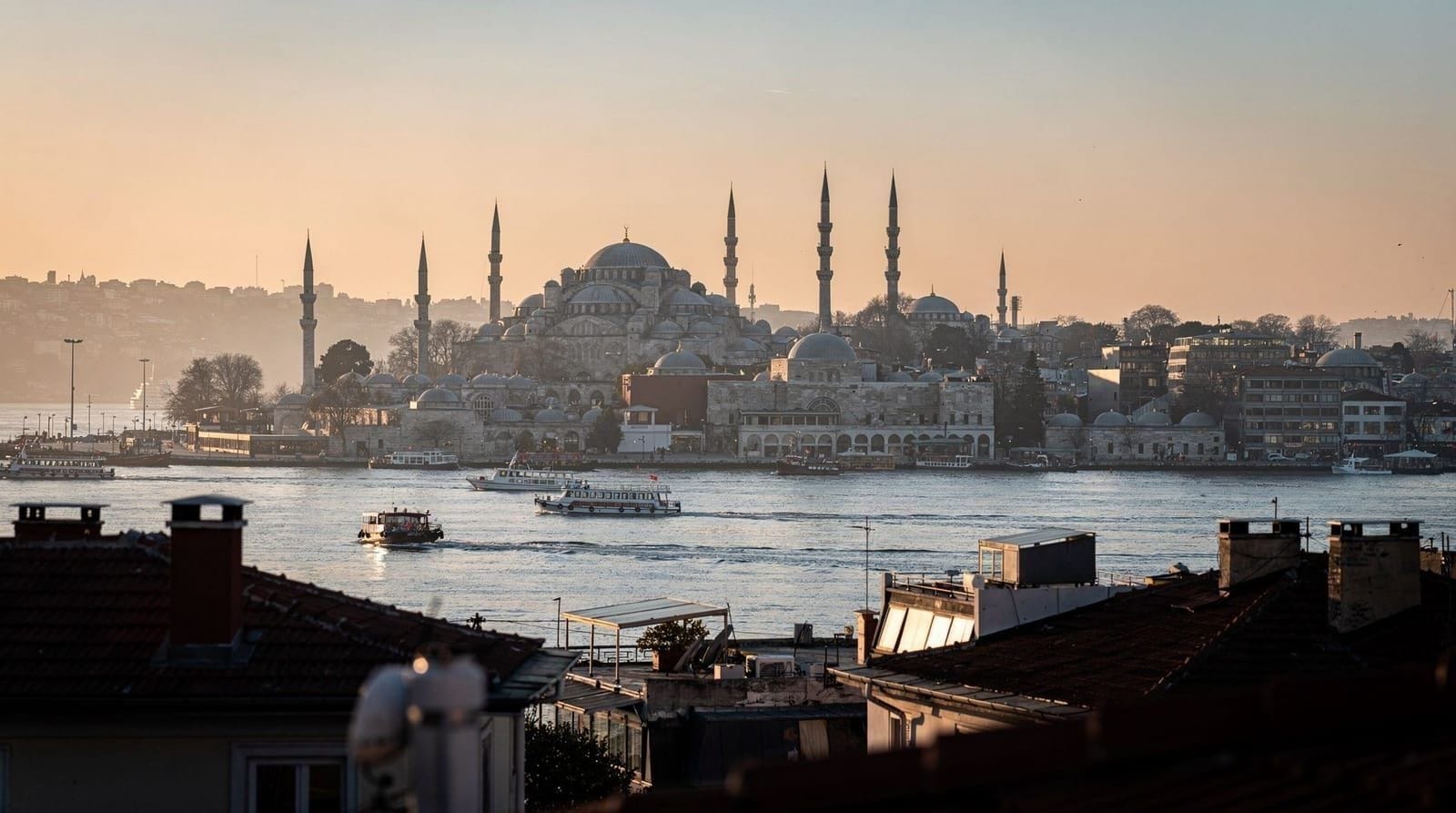
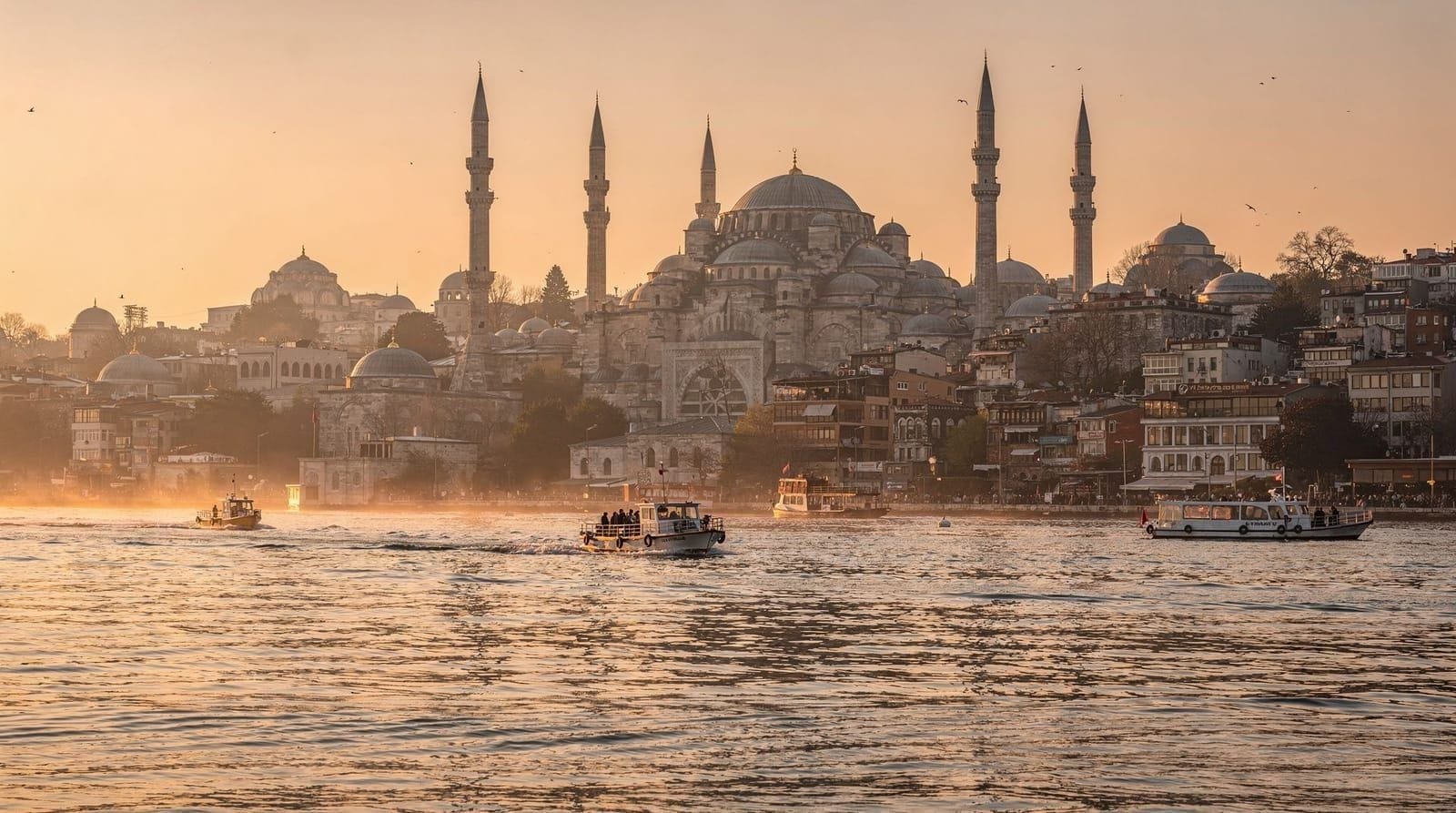
Marmaray: the Bosphorus rail tunnel
Technically a suburban rail line that passes through the Bosphorus tunnel. Key European stops: Sirkeci (adjacent to Eminönü), Kazlıçeşme, Yenikapı. Asian stops: Üsküdar, and beyond.
- Sirkeci to Üsküdar: approximately 4 minutes
- Accepts Istanbulkart
- Enormously convenient for quick Bosphorus crossings
The Marmaray is essentially an underground shortcut across the Bosphorus. It replaced centuries of ferry dependency for the daily commute of hundreds of thousands of Istanbulites.
Other metro lines
Istanbul has additional metro lines covering suburbs and the Anatolian side (M5, M6, M7, M8, M9). For most tourists focused on the historic areas and main neighborhoods, these are rarely needed. The Istanbul metro map (downloadable from Istanbul Metropolitan Municipality website or apps like Moovit) shows all current lines.
The T1 tram: the tourist spine
The T1 is the light rail tram running along the main east-west axis of tourist Istanbul. This is the most-used transit line for visitors.
Key T1 stops (west to east, European side):
| Stop | What’s there |
|---|---|
| Bağcılar (western terminus) | Suburban connection |
| Zeytinburnu | M1 metro connection |
| Yusufpaşa | Near the Istanbul Museum |
| Aksaray | Budget hotel area, M1 metro connection |
| Laleli-Üniversite | Near Grand Bazaar (Kapalıçarşı) |
| Beyazıt-Kapalıçarşı | Grand Bazaar main entrance |
| Çemberlitaş | Near the Column of Constantine, bazaar area |
| Sultanahmet | Hagia Sophia (100m), Blue Mosque (200m) |
| Gülhane | Topkapı Palace lower gardens |
| Sirkeci | Old train station, near Eminönü |
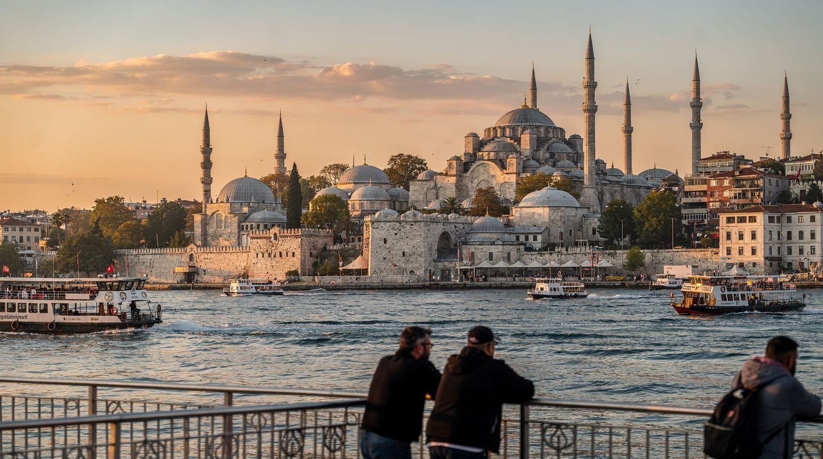
| Eminönü | Ferry terminals, Galata Bridge, Spice Bazaar |
| Karaköy | Galata Tower (10 min uphill), restaurants, ferry |
| Tophane | Istanbul Modern art museum |
| Fındıklı | Residential |
| Kabataş | Ferry terminal; cable car to Taksim |
The T1 runs approximately every 3-5 minutes in daytime peak hours. In the evenings and on weekends, slightly less frequent but reliable.
Funiculars and cable cars
F1 (Tünel): The historic underground funicular in Karaköy/Beyoğlu. Runs between the Karaköy waterfront and the Tünel Square at the south end of İstiklal Avenue. 90 seconds; accepts Istanbulkart. One of the shortest underground railways in the world (inaugurated 1875). Very useful for avoiding the steep uphill walk from Karaköy to Beyoğlu.
F2 (Taksim–Kabataş): The cable car (funicular) from Taksim Square down to Kabataş at the T1 tram waterfront terminus. Used to connect the metro at Taksim with the T1 tram at Kabataş.
Halıç and other cable cars: Some suburban cable cars exist for specific hillside neighborhoods.
Buses (IETT)
Istanbul’s bus network (operated by IETT, the Istanbul Electricity, Tram, and Tunnel Establishments) is extensive, covering areas not served by metro or tram. Buses accept the Istanbulkart.
For tourists, buses are less commonly needed than the metro/tram system — the main sights are well-served by tram and metro. Buses become more useful for:
- Reaching neighborhoods not on tram/metro lines (Moda in Kadıköy, outer Beyoğlu, Bakırköy)
- Short hops within neighborhoods
- The HAVAIST airport service (separate ticketing from standard IETT)
Finding your bus route: the Moovit app or Istanbul Metropolitan Municipality app shows real-time bus locations and journey planners.
Metrobus (BRT)
The Metrobus is a Bus Rapid Transit service running on dedicated lanes along the D-100 highway, with its own platform stops. It connects the far-east Asian suburbs to the far-west European suburbs via the Bosphorus bridge. Heavily used by commuters; limited tourist utility as it does not serve the historic center.
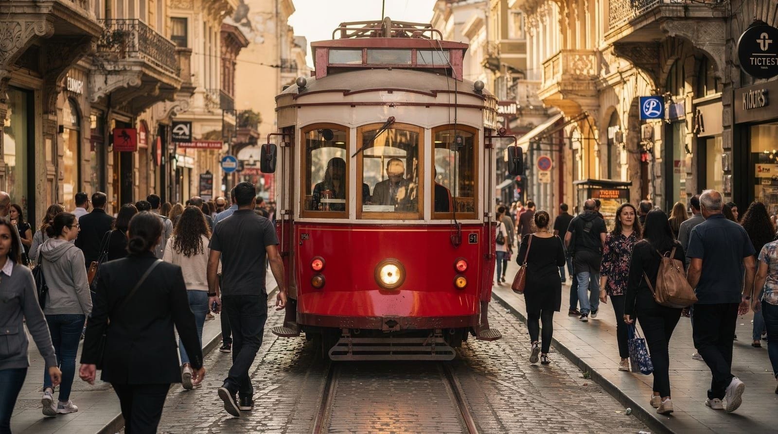
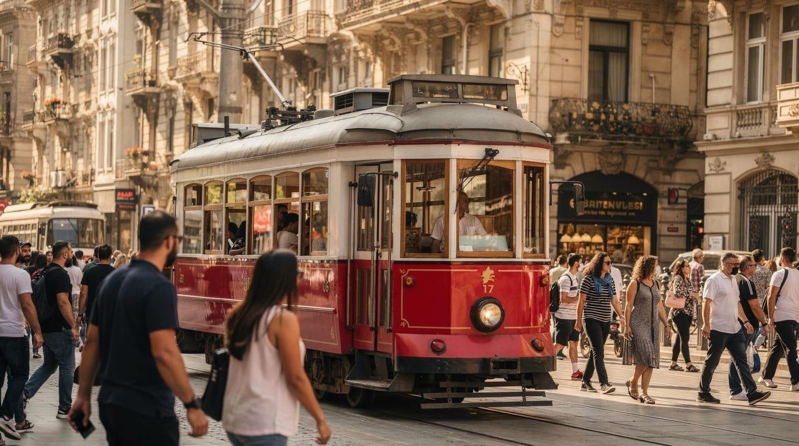
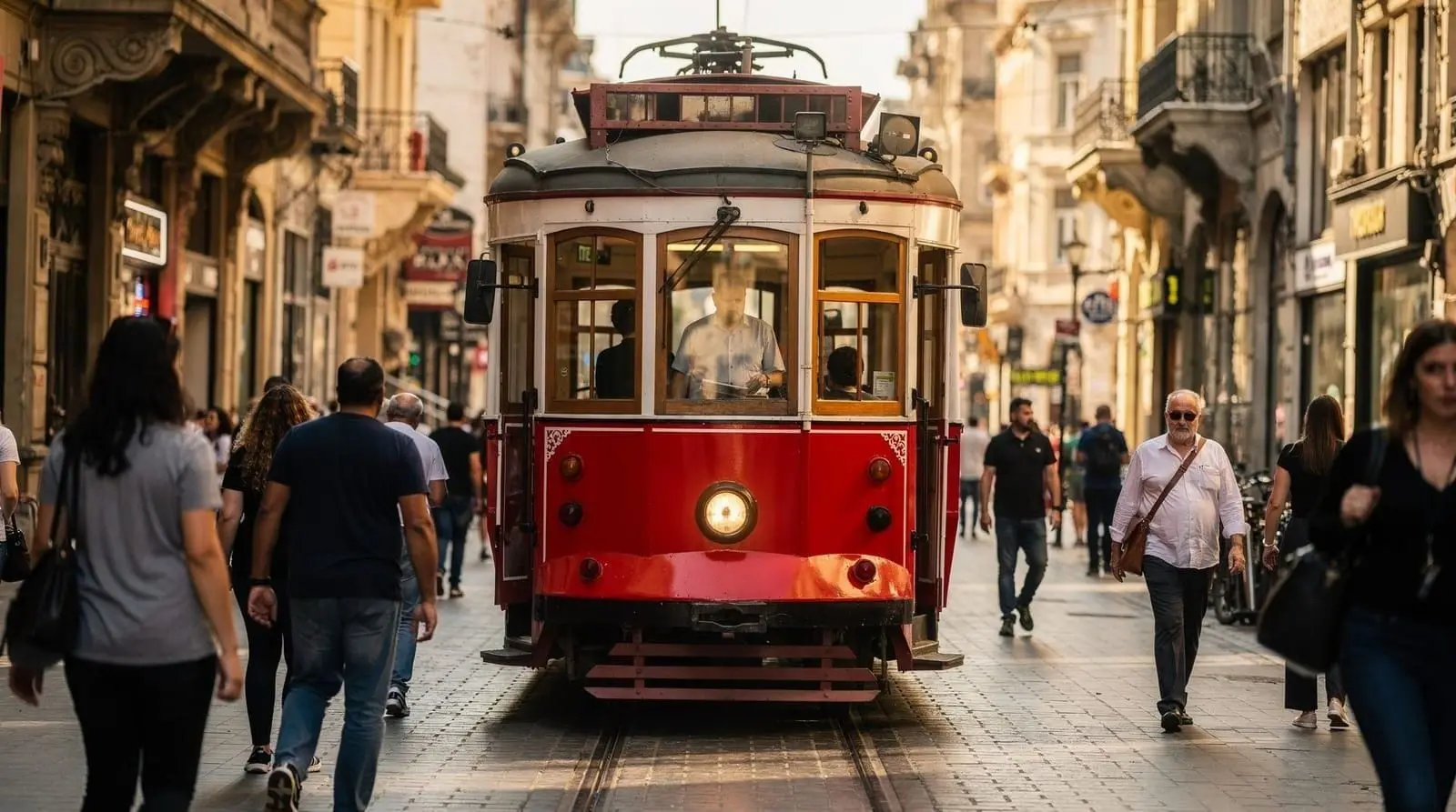
Nostalgic tram on İstiklal Avenue
The Nostalgic Tramvay (T2) is a heritage tram running along the pedestrian İstiklal Avenue in Beyoğlu — approximately 1.6 km from Taksim to Tünel. It is a restored 1910s tram, very slow, and almost always crowded with tourists and locals photographing it. It accepts the Istanbulkart.
Use it once for the photo opportunity if you like; do not use it for actual transport.
Single tickets without an Istanbulkart
Most stations sell single-journey tokens (jeton) from machines for travelers who genuinely only need one or two trips, but the discount math rarely favors this: a single jeton typically costs more per ride than an Istanbulkart tap, and you cannot use the transfer discount. If you are staying more than a day or making more than two or three trips total, the Istanbulkart pays for itself almost immediately. Machines accept cash and card and dispense tokens in seconds, so it is a reasonable fallback if you land late and stations are quiet, but plan to switch to an Istanbulkart the next morning.
How transport compares by mode
| Mode | Speed | Cost per trip | Best for |
|---|---|---|---|
| T1 tram | Moderate, frequent stops | Standard Istanbulkart fare | Sultanahmet-Karaköy tourist corridor |
| Marmaray | Fast, few stops | Standard Istanbulkart fare | Quick Bosphorus crossing (Sirkeci-Üsküdar) |
| Ferry | Slower, scenic | Standard Istanbulkart fare | Kadıköy/Üsküdar crossings with a view |
| Metro (M2/M4/M11) | Fast | Standard Istanbulkart fare | Airport transfers, business district |
| Bus (IETT) | Variable, traffic-dependent | Standard Istanbulkart fare | Neighborhoods off the rail network |
| Hop-on hop-off | Slow, tourist pace | Much higher, separate ticket | Orientation day, limited mobility |
| Taxi/BiTaksi | Fast, door to door | Highest, metered | Late night, luggage, accessibility needs |
For most first-time visitors staying in Sultanahmet or Beyoğlu, the T1 tram plus the odd ferry crossing covers nearly everything; taxis and the hop-on hop-off bus are the fallback rather than the default.
Night transport and getting home late
Rail lines generally wind down around midnight, which catches out visitors who linger over a late dinner or a rooftop bar. After the last tram or metro, your options are a taxi (BiTaksi or Uber both work reliably), a night bus on a handful of core IETT routes, or simply walking if you are already in Sultanahmet or Beyoğlu and your hotel is close. Night buses run a reduced, less frequent schedule and are not well signposted for non-Turkish speakers, so unless you already know the route, a taxi is the simpler choice after midnight. Budget a little extra for this in your Istanbul travel budget if you expect to be out late more than once or twice.
Private airport transfer, meet and greet, no public transport needed on arrivalThe hop-on hop-off bus: an honest assessment
Istanbul has a hop-on hop-off bus service covering the main tourist sites on a circuit. It accepts its own ticketing (not the Istanbulkart) and is more expensive per trip than public transport.
When it is worth it:
- For visitors with limited mobility who cannot walk between sites
- For a first-day orientation before you understand the city layout
- For visiting Dolmabahçe and Beşiktaş efficiently alongside Sultanahmet in a single half-day
When it is not worth it: For people who are comfortable walking and using the T1 tram. The tram is faster, cheaper, and more reliable for the Sultanahmet-Karaköy route.
The hop-on hop-off bus is most useful for an orientation overview or for visitors who prefer not to navigate public transport independently.
Navigating between major neighborhoods
Sultanahmet to Eminönü
T1 tram, 1-2 stops. Or walk downhill (10-15 minutes).
Sultanahmet to Beyoğlu
T1 tram to Karaköy (5 minutes), then F1 funicular to Tünel (2 minutes). Or walk via the Galata Bridge and up through Karaköy (25-30 minutes).
Sultanahmet to Kadıköy (Asian side)
T1 tram to Eminönü (5 minutes), then ferry to Kadıköy (25 minutes). Total approximately 35-45 minutes.
Sultanahmet to Beşiktaş
T1 tram to Kabataş (20 minutes), then walk or bus along the Bosphorus waterfront to Beşiktaş (15 minutes). Or taxi.
Taksim to Sultanahmet
Metro M2 from Taksim to Yenikapı (10 minutes), Marmaray to Sirkeci (5 minutes), short walk. Or cable car F2 to Kabataş, T1 tram to Sultanahmet.
Transport cards and options beyond the Istanbulkart
While the Istanbulkart covers the vast majority of public transport needs, there are a few additional transport payment situations:
HAVAIST airport buses: The official bus service from Istanbul Airport uses its own ticketing (not Istanbulkart). Buy tickets at the HAVAIST counter at the airport or via the HAVAIST app.
HAVABUS from SAW: The Sabiha Gökçen airport bus service also has its own ticketing.
Private ferry companies (Dentur Avrasya, Turyol): Run supplementary ferry routes on some Bosphorus crossings. Buy tickets at their ticket offices at the ferry terminals. These do not accept the Istanbulkart.
Dolmuş (shared minibus): Dolmuş vehicles (often minibuses or shared taxis on fixed routes) sometimes accept the Istanbulkart, sometimes require cash, and sometimes operate on their own pricing. Less formalized than the IETT bus system.
Planning a typical tourist day using public transport
Sample day: Sultanahmet → Beyoğlu → Kadıköy
Morning: Start at your Sultanahmet hotel. Walk to Hagia Sophia (10 minutes). After visiting, T1 tram from Sultanahmet stop to Eminönü (5 minutes). Take the Kadıköy ferry from Eminönü ferry terminal (25 minutes). Spend the morning in Kadıköy — market, Çiya Sofrası lunch.
Early afternoon: Return ferry from Kadıköy to Eminönü or Karaköy (25 minutes). T1 tram to Karaköy stop (1-2 minutes). Walk up to Galata Tower (10-15 minutes steep uphill) or take the Tünel funicular F1 from the Karaköy waterfront to Tünel Square at the bottom of İstiklal.
Late afternoon/evening: Walk İstiklal Avenue from Tünel toward Taksim, exploring side streets and meyhanes. Take cable car F2 from Taksim to Kabataş, then T1 tram back to Sultanahmet.
Total Istanbulkart taps: approximately 6-8. Total cost approximately 120-200 TRY ($3.50-6 USD). Total distance covered: two continents and three neighborhoods.
Navigating the Istanbul Metro: a practical note on the map
The Istanbul metro map looks complex but is manageable if you understand the key transfer stations:
Yenikapı: The main hub where the M1A, M1B lines meet the Marmaray and provide connection to the M2. Most cross-system transfers funnel through here.
Gayrettepe: M11 airport metro meets the M2. If arriving from IST, you pass through here.
Taksim: M2 and the F2 cable car to Kabataş. The top of the İstiklal Avenue axis.
Kabataş: Western end of the T1 tram; where the F2 cable car from Taksim arrives. Also a ferry terminal and the jumping-off point for the Bosphorus shore.
Kadıköy: The main Asian-side metro hub (M4) and ferry terminal. Connection point for everything on the Asian side.
Getting to any tourist destination requires knowing which of these transfer stations is on the route between your starting point and destination. Most routing apps (Google Maps, Moovit) handle this automatically.
Accessibility on Istanbul public transport
Istanbul’s transport infrastructure has variable accessibility for visitors with mobility challenges:
Metro stations: Newer metro stations (M2, M4, M11) typically have lifts/elevators and tactile paving. Older stations and the T1 tram stops are less uniformly accessible.
T1 tram: Low-floor vehicles on the T1 allow wheelchair access at most stops. Some older stops have gaps or raised platforms that require assistance.
Ferries: The Şehir Hatları ferries are large vessels; boarding requires crossing a gangway that can have a slight step. Staff assistance is available. Not suitable for users with very limited mobility without pre-notification.
Buses: IETT buses have low-floor models on many routes with wheelchair ramps. Coverage varies by route age and renovation status.
Taxis and private transfers: Accessible vehicles can be requested via BiTaksi (there is a filter for vehicles with larger access) or through private transfer companies that offer accessible vehicles.
Istanbul is not a fully accessible city — the historic cobblestoned streets, steep hills, and uneven surfaces are significant obstacles for wheelchair users and those with limited mobility. The hop-on hop-off bus, with its higher vehicles and various stops, can be more practically accessible for some visitors than the metro/tram system.
Apps that make Istanbul transport easier
Google Maps: Works reliably for Istanbul transit routing. Includes metro, tram, ferry, and bus schedules with real-time data on most lines.
Moovit: A transit-specific app with Istanbul’s full network. Shows real-time delays and bus positions. Particularly useful for bus routes.
Istanbul Metropolitan Municipality app (İBB): Official city app with transport, service, and event information. Turkish-focused but has some English content.
BiTaksi: For taxis. Shows available drivers on a map, fare estimate, and tracks your trip. The most reliable option for hailing a taxi in Istanbul.
Uber: Also available. Works similarly to BiTaksi for Istanbul taxi booking.
Frequently asked questions about Istanbul public transport guide — metro, tram, bus, and ferry explained
What is the most useful public transport line for tourists in Istanbul?
How do I transfer between metro, tram, and ferry?
How do I read Istanbul's metro map?
Is there a 24-hour metro in Istanbul?
What is the Marmaray and how do I use it?
What is a dolmuş?
Is the hop-on hop-off bus part of public transport?
Top experiences
Bookable activities with verified prices and instant confirmation on GetYourGuide.