Getting around Istanbul — transport guide for visitors
Istanbul: Hop-On Hop-Off Bus Ticket
What is the best way to get around Istanbul?
The Istanbulkart rechargeable card covers metro, tram (T1), buses, and ferries — buy one at any metro station. The T1 tram handles most Sultanahmet-to-Karaköy movement. Ferries are cheap and scenic for crossing to the Asian side. Taxis are widely available but always confirm the meter is running; using BiTaksi or Uber by app is safer.
Istanbul transport: the overview
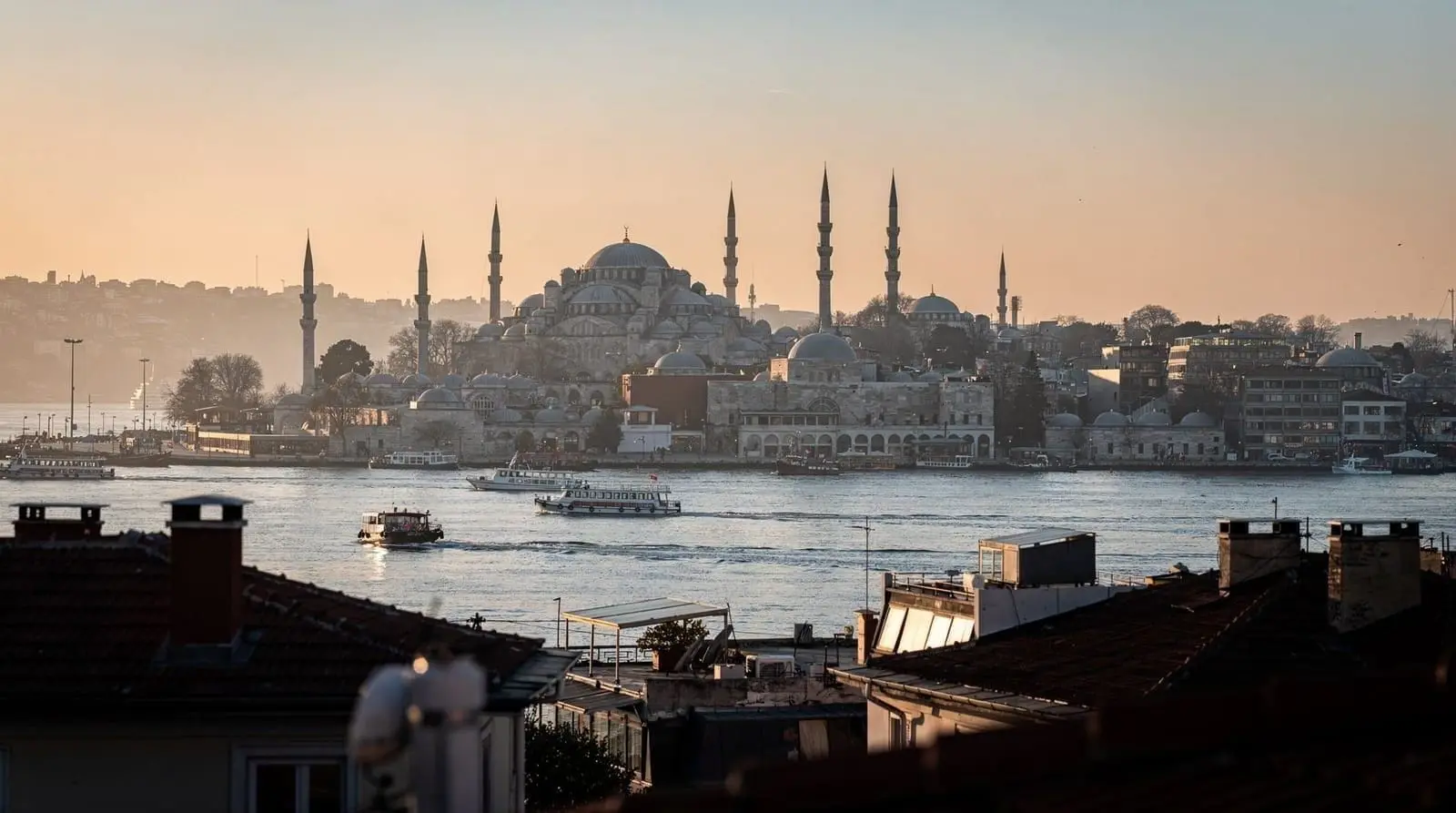
Istanbul’s public transport system is more comprehensive than most visitors expect. Metro lines reach the airport, trams pass through the historic center, and city ferries cross the Bosphorus regularly. For tourists who understand the system, getting around is cheap, efficient, and often enjoyable — the ferry crossing from Eminönü to Kadıköy, for example, is one of the great 25-minute urban journeys in the world.
For tourists who arrive without understanding it, Istanbul can feel confusing. This guide gives you the specific routes you need.
| Card to get | Istanbulkart, from any metro station or the airport |
| Cost | ~100 TRY for the card + 200-300 TRY loaded per day |
| Main tourist line | T1 tram — Sultanahmet to Karaköy and Kabataş |
| Crossing to Asia | Ferry (~25 min, scenic) or Marmaray (~4 min, faster) |
| Airport to centre | 55-90+ minutes depending on airport and mode |
Step 1: Buy an Istanbulkart immediately
Before anything else, get an Istanbulkart — the rechargeable transit card that works on every mode of city transport. Buy one at the metro station inside Istanbul Airport (IST) as you arrive, or at any metro station or ferry terminal in the city.
Cost: 100 TRY for the card plus whatever you load. Load 200-300 TRY for a typical day of tourist travel. Use it on every trip — tram, metro, bus, ferry. It is significantly cheaper and faster than buying individual tickets, and each additional tap after the first within a short transfer window is discounted, which rewards multi-leg journeys (tram then ferry then tram again, for instance) over piecing together separate single tickets.
See our Istanbulkart guide for the full details on buying, loading, and using it.
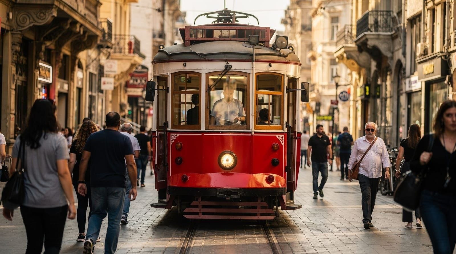
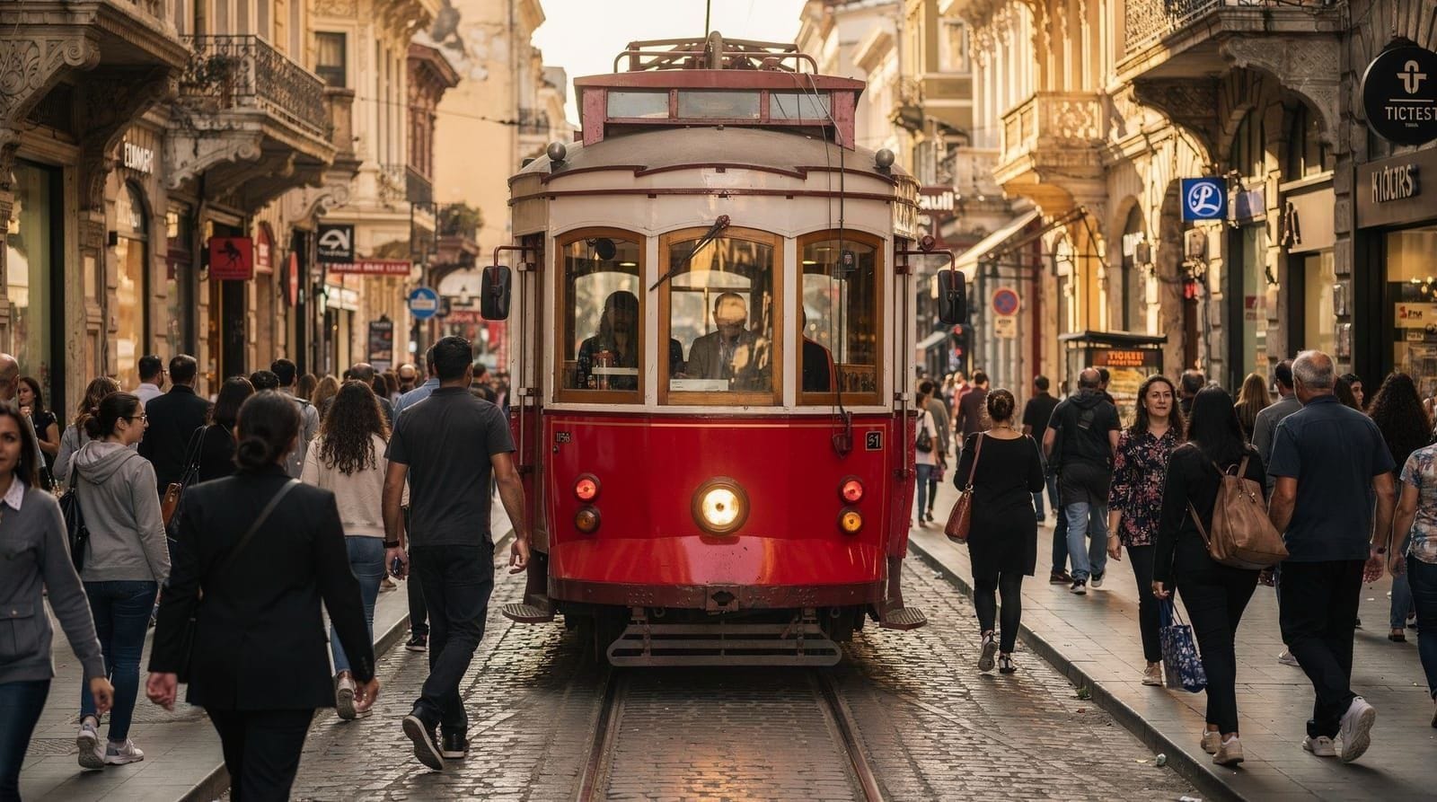
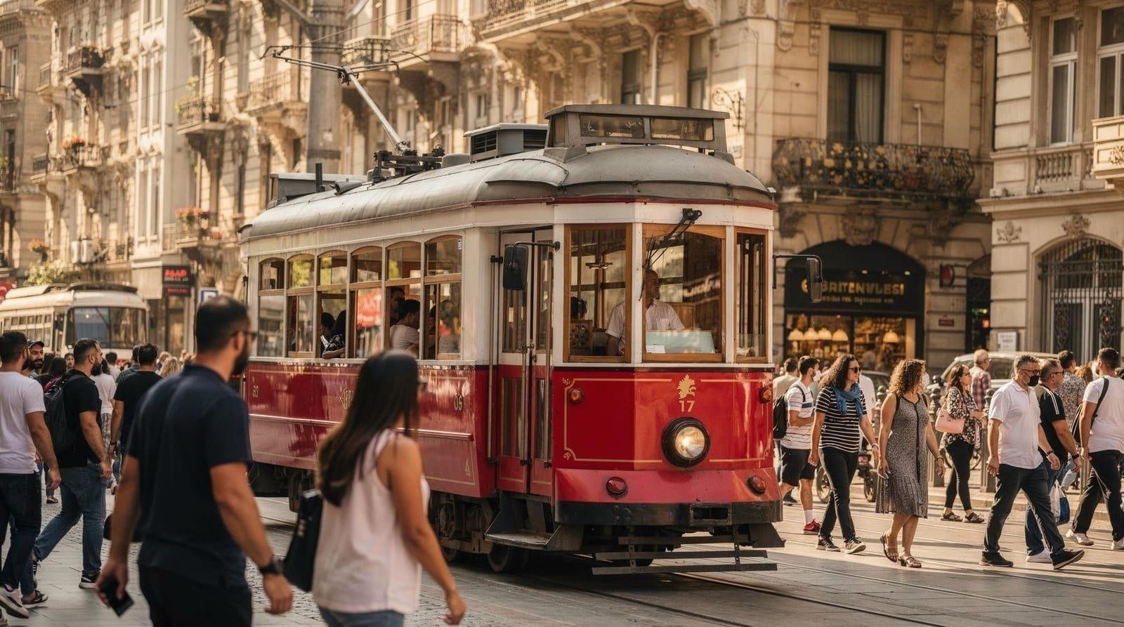
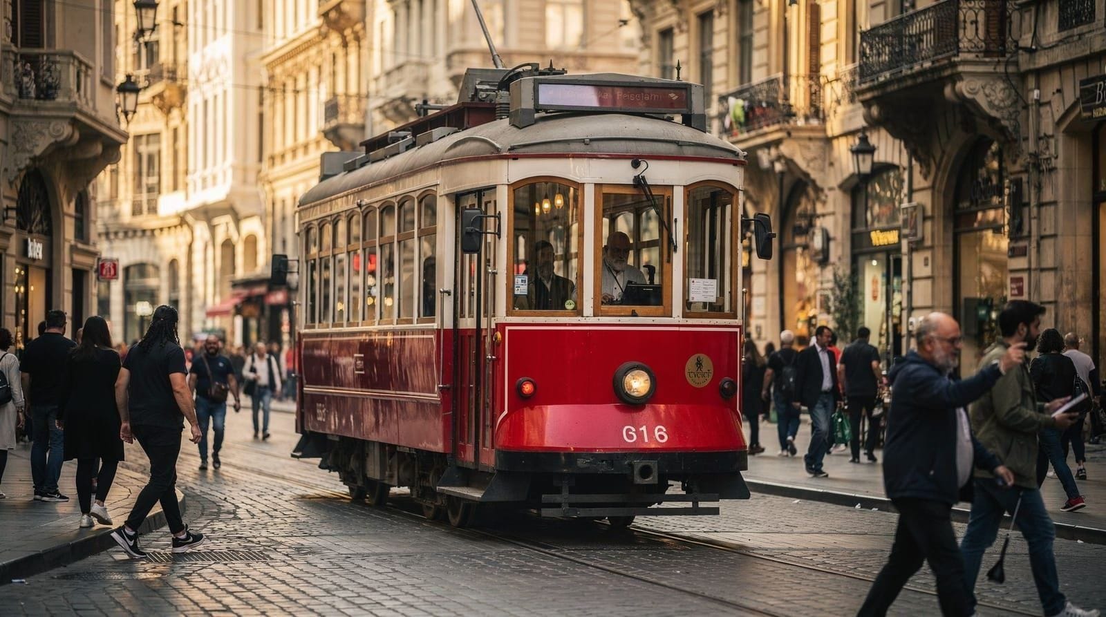
The T1 tram: the main tourist line
The T1 tram is the single most useful piece of public transport for most Istanbul visitors. It runs east-west along the historic peninsula and across the Galata Bridge.
Key T1 stops for tourists (east to west):
- Sultanahmet: Hagia Sophia (100m), Blue Mosque (200m), Basilica Cistern (300m)
- Gülhane: Near the Topkapı Palace garden entrance (lower approach)
- Sirkeci: The historic European rail terminal; near Eminönü
- Eminönü: Ferry terminals, Galata Bridge, Spice Bazaar, the waterfront
- Karaköy: Gallery district, Galata Tower (10 min uphill), restaurant area, ferry terminal
- Tophane: Istanbul Modern art museum, Bosphorus viewpoint
- Kabataş: Western terminus of the T1; cable car up to Taksim
Frequency: Every 3-5 minutes in daytime peak hours. Reliable.
Fare: Approximately 17-25 TRY per trip with Istanbulkart.
Metro lines: where they go
Istanbul has multiple metro lines. The most relevant for tourists:
M2 (Yenikapı–Hacıosman): Connects Yenikapı (connection with Marmaray for Asian side access) through Taksim and Levent (business district) to the northern suburbs. Use this to reach Taksim/Beyoğlu from the Marmaray connection at Yenikapı.
M11 (Istanbul Airport–Gayrettepe): Airport metro. Direct from IST airport to Gayrettepe, where you transfer to the M2. Journey approximately 35-40 minutes.
M4 (Kadıköy–Sabiha Gökçen Airport): Metro on the Asian side, connecting Kadıköy to Sabiha Gökçen Airport and suburban areas. Useful if arriving at SAW.
Marmaray (rail tunnel under the Bosphorus): Connects the European and Asian rail networks underground. Key stops: Sirkeci (European side), Üsküdar (Asian side). Journey time: approximately 4 minutes under the Bosphorus. Uses Istanbulkart.
Ferries: crossing the Bosphorus and reaching the islands
City ferries (operated by IDO/Şehir Hatları and accepted on Istanbulkart) are the most pleasant way to cross the Bosphorus. The main routes for tourists:
Eminönü ↔ Kadıköy: The main route between European and Asian neighborhoods. Frequency: every 15-30 minutes during the day. Journey: approximately 25 minutes. A genuine commuter ferry with a great Bosphorus view. Buy a simit and çay from the ferry snack bar and watch the cityscape.
Karaköy/Eminönü ↔ Üsküdar: Shorter crossing to the Asian side neighborhood of Üsküdar (Maiden’s Tower viewpoints, a more traditional neighborhood atmosphere). Approximately 15-20 minutes.
Eminönü → Princes’ Islands (Adalar): The Şehir Hatları ferry to Büyükada takes approximately 1.5-2 hours. Buy your Istanbulkart top-up in advance for this route.
Full-length Bosphorus ferry (Eminönü → Anadolu Kavağı): This is the public ferry excursion up the full length of the European/Asian Bosphorus waterway. Approximately 2 hours each way; runs once or twice a day from Eminönü. Affordable and scenic. See our Bosphorus by public ferry guide.
Private boats: Companies like Dentur Avrasya and Turyol run additional ferry routes with their own ticketing. They do not accept the Istanbulkart.
The Princes’ Islands round-trip ferry from Istanbul covers the scenic crossing and return — ideal for the Büyükada day trip without navigating the IDO ferry schedule independently.
Taxis: how to use them safely
Official taxis (taksi) are yellow and plentiful in Istanbul. They are metered (taximeter required by law) and should use the meter for all city trips.
The main taxi scam to avoid: Some drivers switch off the meter, quote a flat rate (always higher than the meter would show), or take extremely long routes. Strategy:
- Before the taxi moves, confirm the meter is on — say “taksi metre” or point to the meter device on the dashboard
- If the driver says “meter not working” or refuses: get out and find another taxi
- Use BiTaksi (app available in Turkey) — shows the driver’s route, estimated fare, and trip data. Equivalent to Uber in function
- Uber is also available in Istanbul and is widely used
Approximate fares (June 2026):
- Minimum fare (within city): approximately 100-120 TRY ($3-3.50 USD)
- Sultanahmet to Beyoğlu: approximately 150-250 TRY ($4.50-7.50 USD)
- Sultanahmet to Beşiktaş: approximately 200-350 TRY ($6-10 USD)
- IST airport to Sultanahmet: approximately 500-800 TRY ($15-24 USD) depending on traffic
Always have smaller denomination bills available — the “I don’t have change” issue is a known technique. Keep a rough mental benchmark of what a short in-city trip should cost (well under 200 TRY in most cases) so an inflated fare stands out immediately rather than after the fact.
Airport connections: IST and SAW
Istanbul Airport (IST) to city center:
- Metro M11 to Gayrettepe (35-40 min) → transfer to M2 or bus to Taksim/Marmaray/T1 tram. Total to Sultanahmet: 55-70 minutes.
- HAVAIST buses from IST to Taksim, Eminönü, Beşiktaş, Aksaray and other stops. Approximately 30-120 minutes depending on destination and traffic.
- Taxi/Uber: approximately 45-60 min (low traffic) to 90 minutes (peak traffic). Cost approximately 500-800 TRY.
- Private transfer: fixed-price, pre-booked. See our IST airport guide.
Sabiha Gökçen (SAW) to city center (European side):
- HAVABUS to Kadıköy or Taksim (60-90 minutes). Then ferry from Kadıköy to Eminönü for Sultanahmet access.
- Metro M4 from SAW to Kadıköy (approximately 30-40 minutes) → ferry to Eminönü.
- Taxi to Sultanahmet: 70-90+ minutes in traffic. Expensive.
- SAW is significantly less convenient than IST for the European historic sites. Allow 90 minutes minimum. See our SAW airport guide.
A private airport transfer (meet-and-greet at arrivals) eliminates the transit navigation complexity, particularly useful with luggage on first arrival.
Getting between the main tourist areas
Sultanahmet ↔ Eminönü: T1 tram or 10-15 minute walk downhill. Walking is easy and pleasant.
Eminönü ↔ Karaköy: T1 tram (1 stop) or 5-10 minute walk across the Galata Bridge.
Karaköy ↔ Galata Tower: 10-15 minute uphill walk. Steep. Worth it for the views from the tower neighborhood.
Karaköy ↔ Beyoğlu/İstiklal: Walk uphill (15-20 min, steep) or take the Tünel funicular (F1) from the Karaköy end to Tünel Square at the south end of İstiklal. Takes 90 seconds; accepts Istanbulkart.
Taksim ↔ Kabataş (for the T1 tram): Taksim-Kabataş cable car (F2 funicular). A few minutes, accepts Istanbulkart.
Sultanahmet ↔ Kadıköy (Asian side): T1 tram to Eminönü, then ferry to Kadıköy. Total approximately 35-45 minutes.
Sultanahmet ↔ Beşiktaş/Dolmabahçe: T1 tram west to Kabataş, then short walk or dolmuş to Beşiktaş (15-20 minutes). Or taxi (approximately 20-30 minutes in low traffic).
Walking in Istanbul
Walking is the best way to explore the Sultanahmet cluster and most of Beyoğlu. The historic areas were designed for walking (or horses); the streets between major sites are rarely more than 10-15 minutes apart on foot.
Key walking routes:
- Sultanahmet to Eminönü: downhill, 10-15 minutes
- Galata Bridge to Galata Tower: uphill through Karaköy, 10-15 minutes
- İstiklal Avenue end-to-end: 15-20 minutes
- Balat to Fener neighborhood (Golden Horn side): easy, flat, 10-minute walk between neighborhoods
Walking across the Galata Bridge (from Eminönü to Karaköy or vice versa) is a pleasure — fishermen line the railings, the water is lively with ferries, and the views of the minarets and the Golden Horn are excellent.
Istanbul is hilly: Sultanahmet is on a hill above the Marmara coast. Beyoğlu is on a ridge above Karaköy. Fatih and Fener require uphill climbs from the Golden Horn. Comfortable, flat-soled shoes are not optional — see our Istanbul packing list.
For visitors with mobility limitations or travelling with a pushchair, it’s worth planning routes deliberately around the hills rather than assuming any two neighbouring sights are an easy walk apart — the T1 tram, Marmaray, and funiculars (Tünel F1 and the Taksim-Kabataş F2) all help flatten the city’s elevation changes and are worth using even for short distances that look walkable on a map.
Transport for specific popular routes
Getting to Topkapı Palace
The palace is on the first hill of the old city, above the Gülhane park. The easiest approach:
- T1 tram to Gülhane stop: 5-minute walk up through the park to the main palace entrance, or around the outside walls to the Imperial Gate entrance
- T1 tram to Sultanahmet stop: slightly longer walk through the hippodrome area and past Hagia Sophia to the palace
There is also a back entrance from the Sarayburnu point (the tip of the peninsula) but this requires walking from the T1 tram on the coastal road — fine for an evening walk but less practical with luggage or in summer heat.
Getting to Dolmabahçe Palace
T1 tram to Kabataş (the western terminus), then 10-15 minute walk north along the Bosphorus waterfront road. Or taxi from anywhere in Sultanahmet (approximately 20-30 minutes, approximately 200-300 TRY as of June 2026). Dolmabahçe is in Beşiktaş, which is not otherwise on the T1 line; some taxis confusingly call the palace stop “Dolmabahçe” but the tram stop is Kabataş.
Getting to the Chora Church (Kariye Camii)
The Chora church with Istanbul’s finest Byzantine mosaics is in the Edirnekapı neighborhood, northwest of Sultanahmet. Transport options:
- T1 tram to Topkapı stop (the gate in the Theodosian Walls, not the palace), then 20-30 minute walk north along the walls to Edirnekapı
- Bus from Eminönü: several routes stop near Edirnekapı
- Taxi from Sultanahmet: approximately 15-20 minutes, 150-250 TRY
Getting to Eyüp Sultan Mosque
Eyüp is at the head of the Golden Horn. Options:
- Golden Horn ferry from Eminönü (30 minutes, Istanbulkart)
- Bus from Eminönü along the Golden Horn (approximately 30 minutes)
Combine the mosque visit with the Pierre Loti café at the top of the hill (cable car from Eyüp square) for the view over the Golden Horn. See the Eyüp Sultan Mosque guide for the full route and timing.
Getting to the Asian side neighborhoods
Kadıköy: Ferry from Eminönü or Karaköy (25 minutes). Or Marmaray from Sirkeci/Yenikapı to Ayrılıkçeşmesi (near Kadıköy) — 10-12 minutes.
Üsküdar: Ferry from Eminönü or Karaköy (15-20 minutes). Or Marmaray from Sirkeci to Üsküdar (4 minutes).
Moda (residential area south of Kadıköy): Tram T3 from Kadıköy ferry terminal (accepts Istanbulkart, 5-10 minutes).
Ride-hailing vs. street taxis: the data
Istanbul’s taxi scam situation has improved since the widespread adoption of ride-hailing apps but has not disappeared. A 2024 survey by the Istanbul Metropolitan Municipality found that a significant percentage of street-hailed taxis still had meter issues (tampering, route manipulation, or refusal to use meter) on routes from tourist areas.
By contrast, app-based taxi bookings (BiTaksi and Uber) have near-zero reported meter incidents because the route and fare are calculated by the app before the driver can manipulate them.
This is not a reason to avoid taxis altogether — for late-night trips, luggage-heavy airport transfers, or getting somewhere the public network doesn’t reach directly, taxis remain a perfectly normal part of getting around Istanbul. The point is simply that the app layer removes the specific ambiguity (meter running or not, correct route or not) that street hailing leaves open to dispute.
Practical implication: Use BiTaksi or Uber for any taxi journey over 100 TRY. The fare estimate, driver tracking, and trip record in the app provide accountability that street hailing does not. Download BiTaksi before you arrive and register a payment method.
For very short trips within Sultanahmet where the walk is faster anyway (Grand Bazaar to Hagia Sophia is 5 minutes on foot; a taxi queue and short ride would take longer), just walk.
Choosing the right mode for the trip
| Mode | Best for | Cost | Watch out for |
|---|---|---|---|
| T1 tram | Sultanahmet-Karaköy-Kabataş corridor | ~17-25 TRY/trip | Very crowded at peak hours |
| Ferry | Crossing to Kadıköy/Üsküdar, scenic value | ~25-35 TRY/trip | Schedules thin out late evening |
| Marmaray | Fastest Bosphorus crossing | Istanbulkart fare | Less scenic, can be crowded at rush hour |
| BiTaksi/Uber | Longer trips, airport runs, peace of mind | Metered, app-estimated | Surge pricing at peak times |
| Street taxi | Short, well-known routes | Metered | Meter/route scams away from tourist zones |
| Walking | Sultanahmet, Beyoğlu, Balat/Fener | Free | Hills, cobblestones, summer heat |
Frequently asked questions about Getting around Istanbul — transport guide for visitors
What are the main public transport options in Istanbul?
Is Istanbul walkable?
How do I get to Beyoğlu from Sultanahmet?
How do I get to the Asian side?
Are taxis safe to use in Istanbul?
What is the metrobus and is it useful for tourists?
Can I cycle in Istanbul?
Top experiences
Bookable activities with verified prices and instant confirmation on GetYourGuide.